Sunday, May 22, 2011

Utah State Hospital

    For the summer I am down in Southern Utah.  Before leaving Provo I took several photos around town so that I can keep up with the blog during the summer.  I plan to focus on Provo for most of the summer, with an occasionally cool place from Southern Utah.
     I first wanted to highlight the Utah State Hospital.  I was amazed at the beautiful architecture that I was finding while researching historic photos of Provo.  Most of the really cool architecture came from the Utah State Hospital (also known as the Utah State Mental Hospital).  Here is the history of the building from the Utah State Hospital website:
     "The Utah State Hospital began as the Territorial Insane Asylum in 1885 at Provo, Utah (which at the time was a days' travel from Salt Lake City). The particular site in Provo was some eight blocks from the nearest residence and was separated from the city by swampland and the city dump. The message this reveals about the prevailing attitudes regarding mental illness is unmistakable.
     "The intervening years, however, have brought many changes: the swamp has been drained, the dump converted into a municipal park, and the city has expanded to the point that there is no longer a stark demarcation of where the "Asylum" begins.
     "From its origin the purpose of the Hospital was to treat the mentally ill and to return them to a normal level of functioning. In spite of their best efforts, however, in its early days the facility was little more than a human warehouse. In fact, by 1955 the population at the hospital was over 1,500 patients.
     "Over the years, tremendous advances in psychiatric medicine have changed the role of the Hospital to one of very active (and successful) treatment and rehabilitation. Today, it is truly a Hospital in every sense of the word.
     "Furthermore, the Hospital is no longer the primary deliverer of mental health services in Utah; this role changed with the creation in l969, of community mental health centers. Now residents throughout Utah can receive mental health services in their own community. The Hospital has changed its role from the only mental health treatment facility into a supporting role for the community mental health centers.
     "Today the Hospital provides 324 beds for Utah's mentally ill citizens who require treatment in a more structured setting. Treatment is provided to patients ranging from age six years to geriatric age. Specialized programs are offered for children, adolescents, forensic and adult residents.
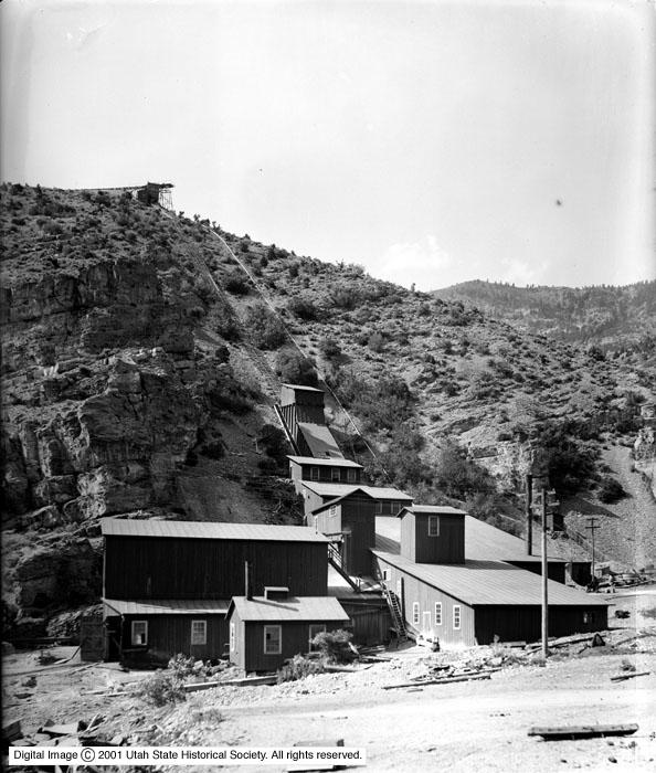
     In addition to the changes in how mental health is approached, there have been dramatic changes to the actual building structures.  If you have been to the hospital anytime recently you would see ugly, bland buildings.  However, the hospital used to look incredible.  I didn't retake any of these photos since it costs $20 to take any photographs on the property.  Rather I just wanted to share a little information about this great historic site.  All of the photos are the information following (which most are quotes) are taken from the Provo Library's historical photo collection.


     This is the original main building.  In the following photograph, you can see the road leading up the the building, which is currently Center Street


    The Milton Hardy Building.  It was constructed in 1908 and was named after Dr. Milton Hardy, who was the Hospital Superintendent at the time of construction.  The building was built to provide housing for women but also provide space for those diagnosed as "feebleminded".  The building was determined to be unsafe and was demolished in 1967.


     This is the dairy building which was located on the campus


     The George Hyde Building.  This building was constructed in 1921 and was named after George Hyde, who was the hospital superintendent at the time of construction.  The building housed a variety of patients until 2004 when it was determined unsafe and demolished.


     The Infirmary Building


     The Shop Building.  The first floor was built to provide various workshops for patients to produce items for use at the hospital.  The basement was used for storage.  Before the completion, a second floor was added to provide living space for male patients at the hospital who were diagnosed as "feebleminded".  The building was demolished in 2006. 


     This is a picture of the stage of what is known as the castle on the Mental Hospital grounds.  It is a beautiful building surrounded by a nice park, pond, and mini golf course.  I have always been interested and intrigued by this building.  While researching for this post, I found out that this was built during the 1930s as part of the Works Progress Administration (which was intended to get people back to work).  They built it as a source recreation and entertainment for patients at the hospital.  It is included on the National Register of Historic Places.  The castle is also featured in the next couple of photos.


    I have never been able to find a historic map of the State Hospital so if anyone knows where to find one, let me know.  Because of that, I don't know where exactly on campus any of these buildings were located, with the exception of the main administration building and the castle.
     I wanted to add a couple of extra tidbits about the hospital.  I was told in my Abnormal Psychology class that they used to have haunted houses during Halloween on the hospital grounds.  Patients at the hospital would dress up and participate in the haunted house while people from the community walked through it (yes, I know, it sounds crazy and unethical).  Apparently it was a big hit among community members until someone one year was stabbed by a patient from the hospital.  Since then it has not been continued.
     Also, in regards to the weird, abandoned lodge behind Seven Peaks (on 300 North) that everyone claims is part of the old Mental Hospital.  I don't believe that it is or was ever part of the State Hospital (if anyone can support or deny this, I'd love more information since I have only one source).  First of all, its design and the lack of a fence around the property makes me think that it was never intended for mental patients.  Also, I heard that originally Seven Peaks was supposed to be a ski resort.  The idea was to build a lift up over Y Mountain and have people ski on the back side.  This makes a lot more sense to me since the building looks like a ski lodge.  I was told that funds ran out and rather than a ski lodge a water park was created.  Also I was told that some of the wood that was going to be used for the ski lift can be found around Provo (it was sold to individual families).  The person who told me this information told me that the they have lots of the wood and used part of it for a retaining wall.

Thursday, May 19, 2011

Ophir and King Solomon

     Today is the concluding post about my travels through the area around northwestern Utah Lake.  I wanted to quickly leave Mercur, especially since there wasn't anything there, so that I could get to the town of Ophir.  And no, I am not referring to the city which is mentioned in the Biblical book of Kings which delivered King Solomon a "cargo of ivory, and apes and peacocks, sandalwood, cedarwood, and sweet white wine."  I am talking about the beautiful city located in Tooele County.
     According to ancestry.com, "In the 1860s, off-duty soldiers, encouraged by their commanders, began to engage in prospecting in the mountains of northern Utah.  Some of these men became aware of the silver possessed by the Indians in the area and persuaded the Indians to show them where the ore had come from.  This led them to East Canyon in the Oquirrh Mountain Range.
     "Prospecting and small scale mining in East Canyon began sometime during the late 1860s.  The canyon was renamed Ophir after the Ophir in the Bible where King Solomon got his gold and silver.  On August 6, 1870, the Ophir Mining District was organized in Ophir City.  On the 23rd of August in 1870 the first mining claim in the Ophir District was made.  It was called Silveropolis.
     "Like many boom towns, Ophir began to grow rapidly.  By 1871, Ophir City boasted 125 businesses and bouses, a school, and a post office.  Also in 1871, the first stamp mill in Utah began operations in Ophir....
     "Most of the ore taken out of Ophir was lead, silver, and zinc with copper impurities.  There wasn't much gold."  The following photos of the town were taken right after the beginning of the 20th century:

  Used by permission, Utah State Historical Society, all rights reserved.

  Used by permission, Utah State Historical Society, all rights reserved.

 Used by permission, Utah State Historical Society, all rights reserved.

 Used by permission, Utah State Historical Society, all rights reserved.

 Used by permission, Utah State Historical Society, all rights reserved.

      Also according to ancestry.com, "Unlike many mining towns however, Ophir did not die.  Smaller scale mining continued on into the next century.  Most mining was done by small partnerships and family operations.  Those who remained worked in the mines and raised their families.  The city government, post office, and school remained in operation.  Community activities began to replace the saloons.  The city was host to an IOOF Lodge, and the local baseball team was a source of much pride.  there were also dances and other socials to keep the young people entertained."
     Ophir is a really cool town that I would recommend to everyone check out.  It is a really cute and charming town.  It has been up kept exceptionally well, which I am told is due to several government grants which the town has received for the restoration process.  Also, even though the town is extremely small, it is a tourist get-away, especially for horse back riders who want to do a relaxing ride through the mountains.  Here are some of the photos of how the town looks like today (the first three photos are rephotographs of the second, third, and fourth older photos):


     Ophir is nestled in this really tight canyon, but it makes for a really pretty place.  They have also recreated a tiny mining town which is a really interesting area to walk through.  I don't think that Ophir is a very well known town by it is pretty awesome.  I would recommend for everyone to go check it out.  Also the mine is open and you can explore it at your own risk.  For some great photos of the Ophir mine, check out ghosttowns.com.

Friday, May 13, 2011

Ghosts of the Past

    A friend (Thanks Hollie!) sent me this amazing post online to the blog of a Russian fellow who has the same idea as I do (although I must admit that I like his more.  It is so cool).  I had to take a break on my own blogging and feature his amazing work.  These pieces are by Sergey Larenkov.  He wrote the following about what he does:
     "Dear friends, if you're interested in travel into the past, I will try to help you. But be warned, the history often hides a very scary pages, and return to the present is much more pleasant than to travel into the past.     "Most of my work is devoted to the period of World War II. The most powerful impression on me personally produces a series of photos about the siege of Leningrad, this is my hometown. In addition, here you will find the defense of Moscow, the liberation of Prague and Vienna, the storming of Berlin, some pages from the life of Paris. D-day collages will be ready soon.  Some pages of my journal will bring you to the streets of the capital of the Russian Empire, St. Petersburg. 
     "Wherever I go, I'm trying to penetrate the layers of time. It does not always do well, but I try.
Many thanks for the support staff of the State Museum of History of St. Petersburg, as well as staff of the Russian State Documentary Film & Photo Archive, Krasnogorsk.  And of course, fond memories and endless gratitude to the photographers and war correspondents that brought us images of a bygone era.
Happy journey into the past. 
     "Yours, Sergey Larenkov."
    All of the following photos are courtesy of http://sergey-larenkov.livejournal.com/
 Berlin, 1945/2010

 Berlin, 1945/2010

 Soviet-Finnish War(1939-1940). Destroyed railway bridge in Terijoki / Zelenogorsk, 1939/2011

Leningrad/St.Petersburg, 1944/2010

 Leningrad,1942/ St.Petersburg,2010 Kronverkskaya street

 Paris insurrection 1944/2010. Barricade on Quai des Grands Augustins

     I also wanted to include some cool aerial shots of downtown Salt Lake that appeared today on the Salt Lake Tribune website.  The following photos are from the 1960s and can all be found at sltrib.com:

 The foundation of the Church Office Building is visible in this aerial photo from the 1960s. Construction on the 28-story building started in 1962.

 The Sugar House Prison once sat on the land now occupied by Sugar House Park and Highland High School.

This is the old justice complex where the Salt Lake police department and courts were located. This is now the site of the main Salt Lake City library.

 An aerial view of downtown Salt Lake City and Temple Square in the 1960s

This is an aerial view of the University of Utah and the surrounding neighborhood. The area near the center of the photo is where Rice-Eccles Stadium now stands

Thursday, May 12, 2011

Mined out of Existence: A Ghost Town Twice

     Today is a treat for all of you ghost town lovers: today is a double ghost town.  This place has been abandoned as a ghost town not once, but twice.  One day while in Eureka, I read about a little town called Mercur.  I had never heard of it, but I was interested in finding out a little more.  The town is located in Tooele County off of Highway 73.  When driving north on the highway from Lehi, there is a sign marking the road to get to the town (I don't know if there is a similar sign on the southbound side). Here is what I found out about it from Wikipedia:
     "The town first came into being in 1870 as Lewiston, when gold was discovered at the head of the Lewiston Canyon.  A small gold rush began, peaking about 1873; the population reached as high as 2000.  In 1874 the ore started to give out, and Lewiston became a ghost town by 1880.
     "In 1879, a Bavarian miner named Arie Pinedo had discovered a deposit of cinnabar in the area.  The ore contained gold as well as mercury, but contemporary processes were unable to extract it.  Similar discoveries were made throughout the 1880s.  In 1890 the advent of the cyanide process started the gold rush all over again.  Gold was extracted not only from the newly mined ore, but from old tailings as well.  Soon there were enough people to build a new town on the old site, but the name of Lewiston was already taken by then.  The citizens settled on the name Mercur, from Pinedo's claim.
     "In 1902 a fire that started in the business district of the town burned almost the entire city to the ground.  The town was rebuilt and mining again resumed.  In its heyday there were about 5,000 residents of Mercur.
     "Mercur supported a large Italian immigrant community; young men were attracted by the opportunity of high wages and the romance of the American 'wild west'.  With this Italian influence, Columbus Day became an important city event including parades, games and performances by the Mercur City Band."
     By 1913 the mines had shut down, by 1916 there was only one building left in Mercur, and by 1930 everything was gone.  Here are three photos of the town, the first from 1885 and the second two from 1903:

 Photo courtesy of L. Tom Perry Special Collections, Brigham Young University

 Used by permission, Utah State Historical Society, all rights reserved.


Used by permission, Utah State Historical Society, all rights reserved.

    When I drove up the road towards the old city, there is a huge fence blocking the road.  Here is what it currently looks like:


     My friend that came with me (thanks Mikael) debated about whether we should sneak around.  There were several openings in the fence and it ended almost as soon as it crossed the road.  We talked with a man who happened to drive up at the same time and who used to work around the area.  He told us that the company Barrick bought the mine around the 80s (an interesting tid bit is that this company has some relation to the Getty Museum in Los Angeles.  It is a really cool museum and free so if you are ever in LA, go check it out).  They started to mine the area, however they have recently been focused around the Elko area where a huge mine was found.  He said that no one has been here for several years.
     With that bit of confidence, we decided to climb under the fence.  I slipped climbing up a bank onto the road and smashed my knuckles (it has made a really good story for the kids that I work with at Provo High.  All of them keep asking me if I got in a fight.  I always tell them that some freshman was pissing me off so I hit him).  As soon as we started walking up the road a truck came down.  The guy in the truck told us that the property owner would shoot us if he found us on the land (I doubt it...).  The property owner is the current mayor of Ophir (stay tuned for that one!) and operates the Ophir Gophir.  He also said that there was no point heading up the road since the town was mined out of existence.
      Everyone that I talked to said that the town was mined out of existence.  Mining towns are difficult to rephotograph because the landscape is constantly changing and being mined.  Furthermore, since the land is getting mined, you often can't find the original spot that the photo was taken from, because it doesn't exist.  Due to our lack of time and the fact that we were just going to find a big hole, we turned back.  However, I did find a couple of pictures of the current mine.  The first is from utahhikingandlakes.com and the second is from wikipedia:


     The only remains that can be found of the town of Mercur is the graveyard which is located as soon as you turn onto the road towards Mercur.  At least there is a marker for the graveyard.  I didn't have time to explore the area and I actually didn't see any graves.  Here is the marker:

Tuesday, May 10, 2011

The Stagecoach Inn

     If you have read the other 2 posts of Fairfield, then you may have realized that there is something in town called the Stagecoach Inn.  Fairfield is well known for two things: Camp Floyd and the Pony Express.  Today we are talking about the Pony Express.
    If you don't know what the Pony Express is, it was a overland route that existed around the 1860s which served for delivering mail.  It consisted of several way stations where riders could change horses.  This allowed riders to continually be on fresh horses, making the ride much quicker.  I am in love with this podcast that a friend showed me called "Stuff you missed in history class" (and lets be honest, no one really pays attention in history, so you probably missed a lot).  If you would like you can download the podcasts for free on itunes.  They have a great podcast on the Pony Express that I would recommend to listen to.  The most interesting thing that I learned was that the Pony Express was actually an economic failure and only lasted a couple of years.  It was eventually replaced by the transcontinental railroad.
     So to continue on with the Stagecoach Inn, there is a well known building in Fairfield which is actually a state park.   Here are two photos of the inn, the first from 1918 and the second from 1925:


     The plaque in front of the building reads: "Built by Mormon pioneer John Carson in 1858, the Stagecoach Inn served as a stop and hotel on the overland stagecoach route.  The horse-drawn stagecoaches on the route delivered mail and passengers from St. Louis, Missouri, to San Francisco, California.  The trip took 22 to 25 days.
     "Guests at the inn included westward travelers and visitors of nearby Camp Floyd.  General Albert Sindney Johnston preferred the inn because the owner John Carson's refusal to allow liquor on the premises.  Camp Floyd was abandoned in 1861, and the popularity of the stagecoach travel diminished with the completion of the first transcontinental railroad in 1869.  Despite these changes, the inn continued to operate until 1947, serving mainly travelers between Salt Lake City and the mining camps of western Utah and eastern Nevada."  One interesting guest who probably stayed at the inn was Mark Twain and his brother as they traveled through Utah.
    A plaque which includes several tidbits about Camp Floyd was installed across the street from the inn, probably around the 50s.  Here is a picture of the installation in addition to how the site currently looks:

Used by permission, Utah State Historical Society, all rights reserved.


     Like I said earlier, the inn is located at the Camp Floyd and Stagecoach Inn State Park.  Next to the inn is a beautiful park with an amazingly huge tree.  At the park you can find instructions if you would actually like to travel on what was the Pony Express trail.  It starts in Fairfield and ends in Ibapah (a little city on the Utah-Nevada border) 133 miles later.  Only 7 miles of the trail are asphalt so if you do try it out, make sure you are ready for a dirt road and lots of desert.  Here is a picture of the park and a map of the trail:


Monday, May 9, 2011

Fairfield School

     Continuing with the trip in Fairfield, there is a really cool school building in the town.  Here are a couple of photos of the school, although I don't have a date on either one:


Used by permission, Utah State Historical Society, all rights reserved.

     The plaque in front of the building reads: "The Fairfield District School was built in 1898, replacing Fairfield's original adobe school built in 1870.  Richard C. Watson, the school's architect, also designed the Peteetneet School in Payson, Maeser School, and the Knight Block Building in Provo.
     "Ethel Warnick Mecham, who taught at the school in 1925, recalled there were about 20 children attending classes.  'The kids loved stories and singing songs,' she said.  'At recess they played Rounders and the boys liked to wrestle.'"
     "The school was forced to close in 1939 despite the efforts of Fairfield parents, students and teachers to keep it open.  Restoration of the schoolhouse was completed in 2005.
     "Today, the schoolhouse plays an important part in the educational mission of Camp Floyd/Stagecoach Inn State Park and Museum.  It is used for social gatherings, educational programs and local meetings."
     The National Register of Historic Places marker adds additional information.  It reads: "This one-room, Victorian Eclectic style school... [was built by] Andrew Fjeld, a brick and stone mason from Lehi.  In addition to serving as the town's only school, the building was used for church and civic meetings as well.  A small brick addition was built on the rear in 1935 to provide restrooms and a furnace room.  The school was closed in 1937 after the decision was made to bus Fairfield school children to the neighboring town of Cedar Fort."
     The restoration process was done quite well and the building appears much like it did in the older photographs: