Wednesday, April 13, 2011

The Ghost Town in Utah County You Probably Never Knew Existed

     I have kind of been on a Ghost Town kick for the past couple of weeks.  It all started when I was just surfing the web and I came across an incredibly interesting story about a Ghost Town on the west side of Utah Lake.  I love living in an area where I think that I know everything about its history, only to find out that there is some cool abandoned town just a few miles away (if you go as the crow flies.  Since I had to drive around Utah Lake, it is more like 30).
     In 1909 Joseph Simpson, R. E. Morrison, and J. E. Davis purchased a 6,880-acre tract of land from the Utah State Land Board for $2.50 per acre.  Their idea was to develop an agricultural community on the western side of Lake Utah.  Much of the land on the western side of the lake is fertile, however it was never settled since there are no rivers on that side of the lake.  Morrison, Simpson, and Davis came up with the perfect name for the community: Mosida (which combined the first two letters of each of their last names).
     During late 1909 through 1911 the area was cultivated in order to support the peach orchards which were envisioned for the area.  Irrigation ditches were dug and a pump house was built which would pump water to the area.  By 1912, 8,000 acres of land had been plowed, 50,000 fruit trees planted, 50,000 bushels of grain harvested (the Provo Herald wrote that "the great sagebrush place has been transformed into orchards and grain."), and a 25-room luxury hotel was constructed.  The hotel was one of the crowning points of the company to lure potential people to Mosida, and it was supposedly one of the best establishments between Salt Lake City and Los Angeles.  Another luxury enjoyed was a ferry which shipped people between Mosida and Provo, which additionally served as a place for dance parties. The Mosida Fruit Lands Company soon added more houses, a store, a post office, and even a school. They imported two French cooks to provide their workers the best of meals at the boarding house.  By 1913 some 400 people had moved to Mosida and were working the farms and orchards.  Here are some pictures of the community:

 Photo courtesy of waterhistory.org


 Photo courtesy of waterhistory.org

 Photo courtesy of waterhistory.org

     However, the whole endeavor quickly turned sour.  The fruit trees began to die as the soil was too salty.  Although some crops, such as grain, did do well in the area, grasshoppers ate them all.  In late 1913 the ferry burnt and transportation to and from the city became extremely difficult.  Pumping the water turned out to be more difficult, especially with the fluctuating levels of Lake Utah.  In 1915, the levels dropped so low that water could no longer be pumped.  The Mosida Fruit Company fell further and further into debt and people slowly left the city.  There were ideas to revive agriculture with sugar beets, but transportation to a market was difficult, especially in winter when the lake froze over.  By 1920 the population had fallen to 67 and by 1924 the town was officially deserted.
     All that is left of the town are a few foundations (such as the foundation of the hotel) and the remains of some other buildings.  Here are some pictures from 1984:

  Photo courtesy of waterhistory.org

 Photo courtesy of waterhistory.org

     I went yesterday to take these photos.  I didn't really know where Mosida was located and I just thought that it was somewhere right off Highway 68.  I drove to about mile marker 15 (I later came to find out that the town is located around mile 12) and asked a man if he could direct me towards the town.  He was very antagonistic and wouldn't tell me at all where it was located.  He said that he was subleasing the property and that he didn't want people to bother it.  He said that he could see the property from where we were, but refused to give any hints as to its location. 
     Unfortunately, the community is not located right on Highway 68 but somewhere closer to the lake.  All the land is private and there are "No Trespassing" signs everywhere!  I wasn't able to find the town and I don't know what shape it is in.  I did find the GPS coordinates (40°07′38″N 111°57′24″W) on Wikipedia if anyone wants to go looking.  Also if you'd like to read more on Mosida, read this Wikipedia article or this amazing history from waterhistory.org.
    While researching Mosida, I did find a really interesting website about a development project going on in Mosida called Mosida Orchards.  There are plans to build a develop a huge community on the west side of the lake right at where the old endeavor failed.  At first I thought that it was just a nice idea, but if you click on the button to find out the property that is available for sale, most of the property has been sold.  I guess that it is going to happen.  I think that this endeavor will definitely be more successful than in the past.  However, I just hope that if it does go through, it wont lead to a bridge going across the lake.  Here is a picture of the area that is planned for development:

Some Loose Ends in Springville

     The last couple of weeks I have been covering lots of places in Springville.  While I am disappointed at some things that I still have yet to find any information about (like the roller mills, the Central School, and the sugar factory), I did want to conclude with a couple additional photos that I found.  The first picture is of the Crandall House in 1908:

Courtesy of the L. Tom Perry Special Collections, Brigham Young University

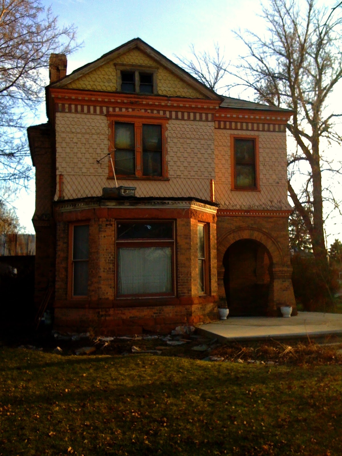
     When I went to this house, the current owner told me that all of the information regarding the house is located on the internet.  Well, I search for a while and found that "another popular style in [Springville] district at the turn of the century was the Romanesque Revival, also known as Victorian Romanesque.  The twin Crandall homes at 112 E. and 136 E. 200 N. are two-story, combination side-passage and central-block with Victorian Eclectic shingling and rusticated Romanesque entry."  That's about all of the history that I could find.  And that the houses are sometimes referred to as the Clarence L. and Nelson D. Crandall homes and that it has been on the national register of historic places since January 19, 1983.  So not too much information.  I really wanted to include these homes because they are so beautiful and well constructed.  Here is the rephotographed picture and then the two buildings from the front:


     I wanted to add two other pictures to close out my time for now in Springville.  The first is a picture of the original city hall, which was torn down in 1968.  I meant to add this photo to my post about downtown and the Star Theatre but I forgot.  The last is a photo from around 254 S Main and I forgot to rephotograph it.  I thought it was interesting and would add a nice contrast for anyone who decides to go and visit downtown Springville.

Courtesy of the Springville Family History Library 

Courtesy of the Springville Family History Library 

Monday, April 11, 2011

Last day in Downtown Springville

     I have really enjoyed my time so far in Springville.  I wanted to do one last day in downtown to cover the rest of the photos that I found.  The first group of photos are of the north area of downtown (so closer to Center Street) and all of them involve the Star Theatre.  Here are a couple, both from around 1915 :

Courtesy of L. Tom Perry Special Collections, Brigham Young University

Courtesy of L. Tom Perry Special Collections, Brigham Young University

     I really like the railroad tracks that used to go right down main street.  I couldn't find any information about the Star Theatre but it has since been torn down.  Now in the its location is the Springville City Hall.  Here are both pictures as they currently are found:


     Here is an additional photo of a building located at 96 N Main from 1890. 

Courtesy of L. Tom Perry Special Collections, Brigham Young University

     Here is the location as it is currently found:


     The building is now the Legends Motorcycle store.  I believe that the building is not the original, but they did a good job to at least replicate the original building.  The final photo of downtown Springville is on the Fourth of July Parade from around the turn of the century.  When I retook the photograph, there was a large tree in the way.  Since the reproduction isn't very good, I will just add the old photograph:

Courtesy of L. Tom Perry Special Collections, Brigham Young University

    I really enjoyed downtown Springville and totally recommend anyone that hasn't been there to go and check it out.

Saturday, April 9, 2011

Burial Spot of Brigham Young's Bodyguard?

     This weekend I went to Rexburg, Idaho for my brother's graduation.  Before I left, he called me and told me about an interesting historic site that was on the way from Utah to Idaho.  He told me that just off of the east side of the I-15 once you cross into Idaho are located two graves.  He said that he was told that the graves belonged to the bodyguards of Brigham Young and that they hated Utah so much that they asked to have their bodies buried outside of the territory.  It seemed like a great entry on this blog. 
     My brother didn't have any other information and even told me that it was just an urban legend.  I attempted to do some research before I left and only could find information regarding two of Brigham Young's bodyguards, Porter Rockwell and John D. Lee.  Porter Rockwell was a well known bodyguard of Joseph Smith and was buried in Salt Lake and John D. Lee was buried in Panguitch after being executed for the mountain meadows massacre.  I figured to solve the mystery I would have to visit the site myself.
    I stopped as soon as I had come to the Idaho border, just in front of the "Welcome to Idaho" sign.  I didn't see any initial signs of a grave, but I did see some fake flowers caught in the barbed wire just to the east of the sign.  I climbed a little slope and found the grave my brother was talking about.  Here are a couple of pictures of the location:


     The gravestone says "Hugh Moon; born Aug 5, 1815; Eccleston, Lancs, England; Joned the L.D.S. church in 1837.  Came to America with the first company of 41 saints.  Arrived in Utah in 1848.  Came to Henderson Creek, Oneida County, Idaho, 1869; Died Sept 23, 1870 at Henderson, Idaho; His wives: Maria Emeline Mott, Elizabeth Kemmish, Jennatt Nicol."
     Ancestry.com gives a great account of Hugh Moon.  It says that "he sailed to America in 1840 after joining the Mormon Church.  he moved to the LDS stronghold of Nauvoo, Ill., where he served as a bodyguard for Prophet Joseph Smith.
     "He crossed the plains to the Salt Lake Valley in 1848, where he married.  Brigham Young asked him to move to Dixie in southern Utah to build up the church there, but he moved again after fire years, this time to Henderson Creek in the Idaho Territory.
     "He died in 1870 at the age of 54.  His wishes were to be buried in Zion which he concluded to be Utah.  Upon his death, his family took him far enough south that they thought they were in Utah, to a small cemetery east or Portage.  As it turned out, the burial site was just inside the Idaho territory."
     There are actually two graves at the cemetery (I didn't see the second at all the first time, but driving south of the 15 I realized that it was there.  I didn't see it at all the first time and I don't know how I missed it.  It is also surrounded by chain-link as well and is a little smaller and set back further from the road).  This is the grave of Jane Copeland Howell.  Ancestry.com states that she "was born in 1789 and grew up on the frontier in Illinois.
     "Her son James married Rosannah Mook in 1857 and they and Jane traveled west with a Mormon pioneer company.  They arrived in the Salt Lake Valley in 1863 and the Howells settled in Kaysville for five years.  They moved to East Portage in the Malad Valley in 1868, where Jane died the next year at age 80.  She adamantly implored her family to bury her in Utah and not Idaho, although she was not a Mormon.  With no border markings, however, she was actually buried in the small cemetery east of Portage."
     So it turns out that neither was a body guard of Brigham Young (although Moon was a bodyguard of Joseph Smith).  And they weren't trying to get out of Utah, but were actually trying to be buried inside of Utah rather than Idaho.  The people that buried them just messed up and buried them a little inside of Idaho.  This humorous accident has remained over almost 150 and has turned into an interesting urban legend.

Thursday, April 7, 2011

Still in downtown Springville

  Suprisingly, downtown Springville is one of the easiest places to rephotograph.  The Bank Building is noticeable in most pictures with its dome.  There is one other building that is very unique and noticeable in most photographs.  Here is one from 1925:

Courtesy of the L. Tom Perry Special Collections, Brigham Young University

     The building that I am talking about is on the left side.  I can't find an official name for it, but it was know as the Caffery and Davis Furniture Company Building or the Senior Hotel (I'll refer to it as the Caffery Davis Building).  On the building is a wonderful plaque that talks about about its history.  It says:
     "This building was constructed in 1890 as the retail furniture store of James Caffrey and Samuel Davis, partners in the firm Caffrey and Davis ('Furniture, Carpets, and Wallpaper'), operating here until 1907, when it was purchased by Walter and Herbert Robinson.  They together with their brothers, formed the Robinson Brothers Music Co., which sold furniture and 'musical merchandise.' In 1921, the building was purchased by Laura Senior.  The Senior family added the rear addition with the second story and operated a confectionery, cafe, hotel, and a billiard hall (an add for the billiard hall can be seen on the building, just above the add for the spearmint gum).
     "Through most of the 1930s, the Senior Hotel was one of three hotels operating in Springville.  Following Laura's death, title passed in 1931 to her son, Oliver, who lived here with his second wife, Priscilla, and his children, Max and Jacqueline.  Max, Oliver's son by his first marriage, worked as hotel clerk and later as manager.  The hotel and associated tourist court (behind the building) continued to be a family owned and operated venture through the 1950s, closing in the 1980s, after which the building sat vacant.  In May 1995 Bradley and Elizabeth Petersen purchased the building and began an extensive restoration project to preserve and return it to use."
     Here is the location as it is found today:


     The Caffery Davis Building still looks quite magnificent and the renovation was done very well.  It is easy to distinguish due to its two unique beehive looking additions to the top corners of the building.
     A couple of notes about some other buildings that are noticeable in this picture.  There is a building about four to the right of the Caffery Davis Building which has a red top with little turrets on it.  This is the Brown House.  It is now a local place for art exhibits.  It is run by Marilyn Brown, who also runs the Springville Playhouse.  The building that I believe is two to the north of the Brown House is the Rivoli Theatre.  This is an old theatre that is currently unoccupied, although there is a large movement to restore the theatre and use it again.  The theatre opened in 1927 and closed in 2008 (for a incredibly detailed history of the theatre, click here).  There are plans to renovate the building, restoring it to how it looked when constructed, and to house the Springville Playhouse (their current building is scheduled to be demolished sometime in 2011).  I found a quote that says, "Springville’s downtown area is undergoing a period of wonderful transition with the restoration of the historic Reynolds Building, the completion of the new Civic Center and the construction of a new community library.  Your contribution will help to restore a theater that has provided cinematic and theatrical entertainment for citizens in and around Springville since 1927. State Historic Preservation representatives verify that the theater meets the criteria for preservation."  To donate, check out savetherivoli.org.
     I thought that conclude this post, I'd add a couple more photos of the Caffery Davis Building, the Brown Building, the Rivoli, and some cool art that I liked downtown.